Kingborough Council is supporting the Snug foreshore community to prepare as ongoing coastal flooding continues to present challenges.
Acting Mayor Christian Street said that if severe weather, such as heavy rainfall, coincides with high tides, the likelihood of flooding increases around the Snug foreshore.
“To help residents better understand these risks, Kingborough Council has partnered with the Tasmania State Emergency Service (SES) to deliver a Snug Storm and Flood Ready information flyer to the community this week,” Cr Street said.
“It is important that residents understand the conditions that increase flooding risk and how to plan ahead.
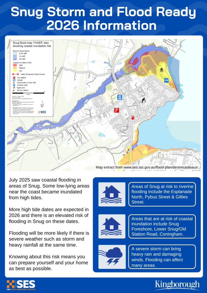
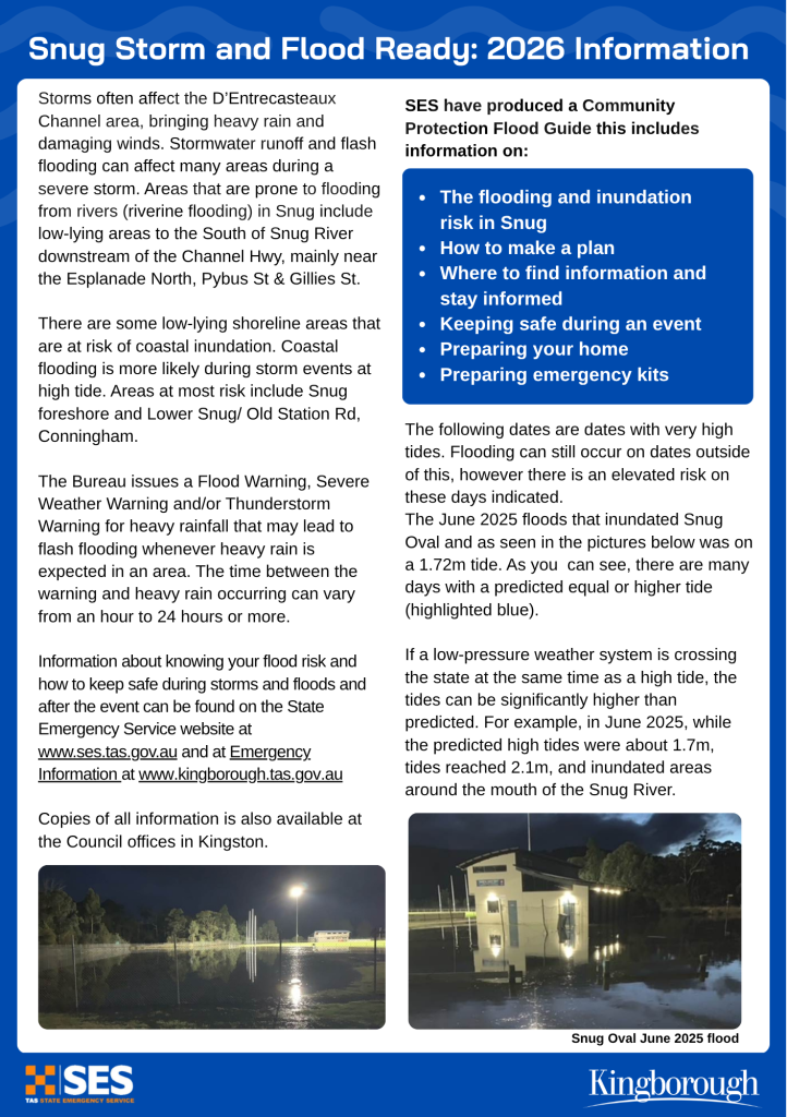
“Coastal flooding was experienced in parts of Snug during July 2025, with more high tide events expected in 2026, bringing an elevated risk of flooding, if the high tides coincide with high rainfall and/or a low-pressure system.
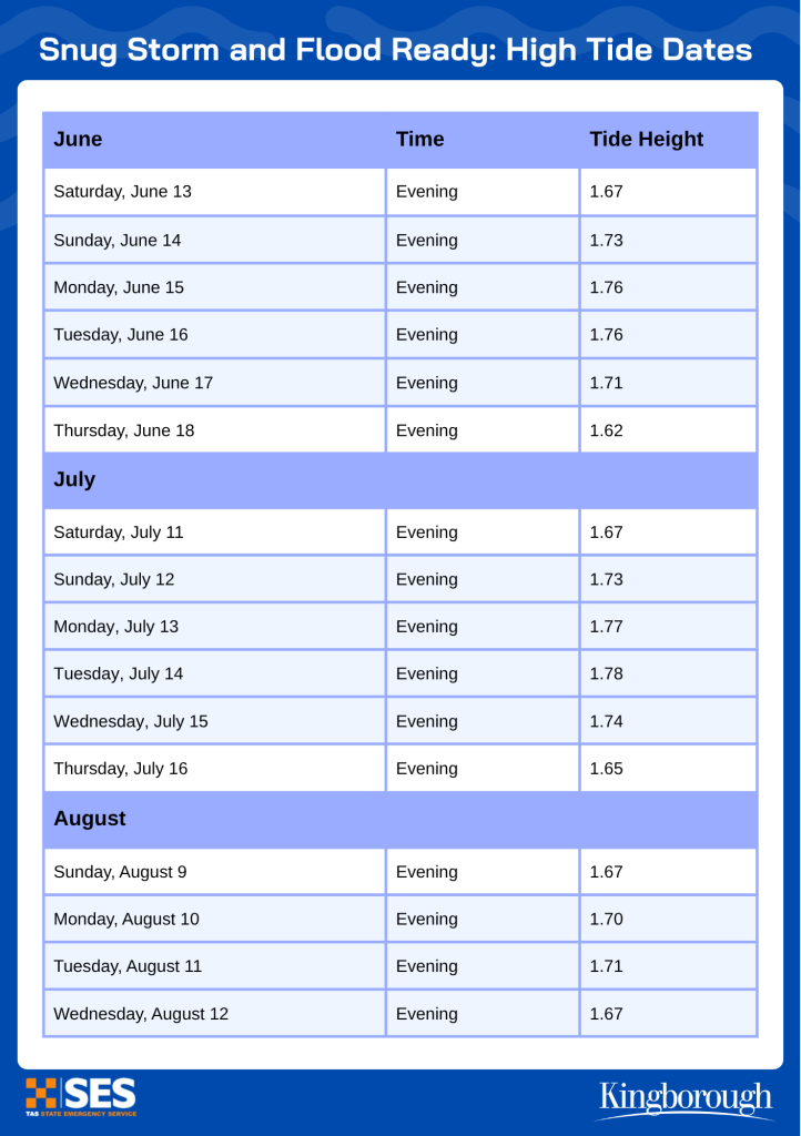
“The flyer sets out the predicted high tides dates in June, July and August and highlights the resources available on Council’s website to help residents prepare, including local flood studies and mapping for the Snug area.
“The SES has produced a draft Community Protection Flood Guide for areas surrounding the D’Entrecasteaux Channel and along with Council has been working with the Snug community through information sessions, helping people understand local flood and coastal risks, prepare emergency plans and build neighbourhood resilience.
“We understand that the Snug foreshore is a much-loved part of the community and developing this information and working with the community alongside SES is an important part of planning for the future.”
Draft flood guides for the Kingborough area, including Snug, are currently available for community input, providing residents an opportunity to have their say on local flood risks and preparedness.
Please see SES website for more information Kingborough draft flood guides – Tasmania State Emergency Service
Copies of all materials available from Council offices.