![]()
Kingborough has a number of beautiful reserves within its Natural Areas Network. These Natural Areas are tracts of native bushland, established for the purposes of conservation, protection and education. Most of the reserves contain significant ecological processes and are habitats for threated flora and fauna.
A number of initiatives have contributed to the preservation of these reserves while creating unique nature based recreational opportunities for residents and visitors. Enjoy hiking, walking, riding, trotting or biking through a number of these beautiful natural areas and explore a number of dedicated ‘Tracks and Trails‘ have been created within or adjoining Kingborough’s Reserves.
See below to find out what Council is doing to manage our Natural Areas and how to get involved or take a closer look into one of our beautiful reserves and plan your next adventure.
Kingborough Reserves
| RESERVE NAME | LOCATION | PERMITTED USES | SNAPSHOT |
|---|---|---|---|
| Algona Reserve | KINGSTON | - CAT PROHIBITED RESERVE - Dog Walking - on lead and formed tracks only - No camping - No fires - Bicycle riding permitted - Motorbikes prohibited | 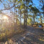 |
| Barretta Reserve | BARETTA - SOUTH OF MARGATE | - Dog Walking - on lead and formed tracks only - Horse riding permitted - Bicycle riding permitted - Motorbikes prohibited | 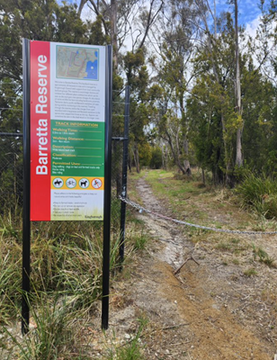 |
| Boronia Beach Reserve | KINGSTON | - CAT AND DOG PROHIBITED RESERVE - Camping prohibited - Camp fires prohibited - Motorbikes prohibited - Sections of this foreshore are dangerous - Area is under surveillance | 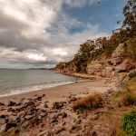 |
| Boronia Hills Reserve | KINGSTON | - Dog Walking - lead and formed tracks only - Horse riding prohibited - Bicycle riding prohibited - due to erosion problems - Motorbikes prohibited |  |
| Browns River Reserve | KINGSTON | - Dogs prohibited Dog beach located directly across from reserve at Tyndall Beach - Motorbikes prohibited | 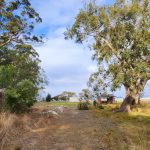 |
| Coffee Creek Reserve | KINGSTON | - CAT AND DOG PROHIBITED RESERVE - Camping prohibited - Camp fires prohibited - Motorbikes prohibited - Bike prohibited on nature trails (only permitted on fire trails) | 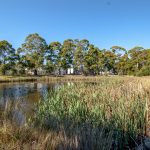 |
| Denison Street Reserve | KINGSTON | - Dog Walking - on lead and formed tracks only - No camping - No fires - Motorbikes prohibited | 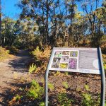 |
| Hawthorn Reserve | KINGSTON | - Dog Walking - on lead and formed tracks only - Bicycle riding permitted - No camping - No fires - Motorbikes prohibited | 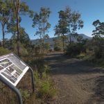 |
| Manuka Hills Reserve | KETTERING | - Dog Walking - on lead and formed tracks only - No camping - No fires - Motorbikes prohibited | 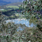 |
| Margate Rivulet | MARGATE | - Dog Walking - on lead and formed tracks only - No camping - No fires - Motorbikes prohibited | 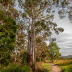 |
| Mary Knoll Reserve | BLACKMANS BAY | - Dog Walking - on lead and formed tracks only - No camping - No fires - Motorbikes prohibited | 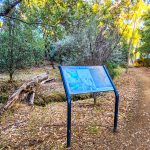 |
| Nierinna Creek Reserve | MARGATE | - Dog walking - on lead and formed tracked only - No horses permitted in Reserve (Horses permitted on Nierinna Creek Track located across road from) - Motorbikes prohibited - No camping - No fires | 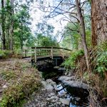 |
| Peggys Beach Reserve | KINGSTON | - Dog walking - on lead and formed tracks only - No camping - No fires - Horses prohibited - Motorbikes prohibited |  |
| Tinderbox Hills Reserve | BLACKMANS BAY | - Dog walking - on lead and formed tracks only - Horse riding permitted - Bicycle riding permitted - Motorbikes prohibited | 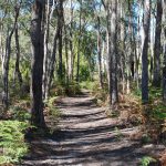 |
| Tramway Hill Reserve | MARGATE | - Dog walking on lead - No camping - No fires - Motorbikes prohibited | 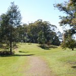 |
| Whitewater Creek Reserve | KINGSTON | - Dog walking - on lead and formed tracks only - Bicycle riding permitted - Motorbikes prohibited | 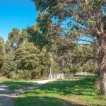 |
A Focus on Reserves
A Focus on Reserves is a compact, foldable handout highlighting some of the plants and animals that live in each reserve. It has been designed in a handy pocket size to take with you while you explore. The guides contain photographs, descriptions and interesting facts about the each highlighted feature. As more are created, there will be additional guides that suit the different seasons as the reserves change as the year progresses. Download guides below.
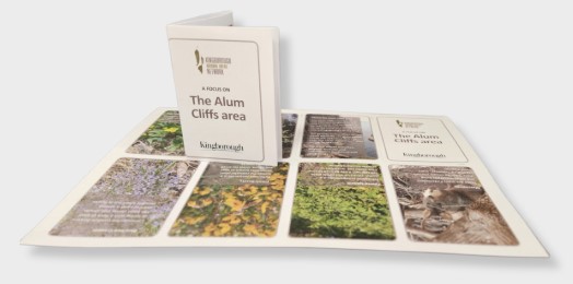
Alum Cliffs
The Alum Cliffs track winds its way between Kingston Beach and Taroona. The sea cliffs can be seen at several viewing spots along the track and show the interesting geology of the area. The geology below often drives which plant life can grow above. While she oaks love dolerite soils, the silver peppermint stay on the mudstone. The track moves between igneous dolerite and sedimentary mudstone and sandstones. Click to Download ‘A Focus on Alum Cliffs’.
Boronia Beach Track
The important coastal vegetation here connects Kingston Beach with Blackmans Bay Beach, allowing the free movement of many wildlife species along its length. The area also contains important seabird nesting habitat. Dominated by the majestic blue gum and whispering casuarinas, the track has stunning views across and down the Derwent Estuary with several seats to rest on along the way.
Click to download ‘A Focus on Boronia Beach Track’.
Peggys Beach
The reserve contains the endangered forest community Black Peppermint on Sandstone. A vegetation community is a distinctive grouping of plants that grow together in the same space. Many of these big beautiful peppermint trees can be seen throughout the reserve.
Click to download ‘A Focus on Peggys Beach’
Dave Burrows Walk
This gentle walk meanders through woodland and coastal scrub, with the path coming close to the mudflats and saltmarsh where many wading birds can be seen at low tide. The area has been rehabilitated by the local landcare group and is now a healthy strip of coastal habitat populated by many woodland birds and animals. There are good views of North West Bay along the track, with several well positioned seats.
Click to download ‘A Focus on Dave Burrows Walk’
Snug Walk
This gentle walk meanders through a rehabilitated forest along the Snug River. Many hands have worked to restore this beautiful place. Walking from the highway down, the forest opens into the estuary where a saltmarsh hosts a variety of shore birds and other plant and animal life. Here the river widens and flows under large trees before reaching the beach.
Click to download ‘A Focus on Snug Walk’
Kettering Point Track
The gentle walk meanders close to the shoreline through the lightly wooded coastal bushland. A variety of birds, orchids, and wildflowers can be seen along the track as well as panoramic views of the D’Entrecasteaux Channel and Bruny Island. The Kettering Coastcare Group cleared away weeds to create this track with a new section now connecting Kettering Point to Trial Bay.
Click to download ‘A Focus on Kettering Point Track’
Tramway Track
The track follows the old Kaoota Tramway, a two-foot gauge tramway constructed in 1906 to transport coal from Kaoota to the wharf at Margate. The first kilometre of the track from Kaoota is a gentle walk
through wet forest to the first bridge. This part of the track is excellent for fungi in autumn, native berry plants and ferns. The track from there to Lawless road takes you through drier forest.
Click to download ‘A Focus on Tramway Track’.